With the rapid development of science and technology, our sight is no longer limited to the ground, but more and more yearning for the endless blue sky and white clouds. Today, let's walk into a fantasy world of science and technology, explore a magical handheld laser cloud detector, and see how it uses "laser pointer" -like accuracy to uncover the mystery of clouds for us.
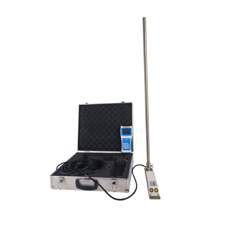
The WX-YG2 handheld Laser Cloud Gauge is a portable device that uses the principle of laser ranging to measure cloud height. Its principle is similar to our common laser rangefinder, but the application field is more unique and high-end. By firing a laser pulse and receiving its reflected signal, the nephoscope can calculate the time difference between the laser's emission and its reflection, and then calculate the distance between the cloud and the device based on the product of the speed of light and the time difference.
Laser ranging technology is famous for its high precision, and the handheld laser cloud detector is no exception. It can provide centimeter-level or even millimeter-level measurement accuracy, allowing users to more accurately understand the true height and distribution of clouds. This is of great significance to the fields of weather forecasting, climate change research and aviation safety.
The application range of hand-held laser cloud measuring instrument is very wide. In the field of meteorology, it can provide real-time and accurate cloud height data for meteorological departments to help meteorologists better predict weather changes; In aviation, it can provide pilots with important information about cloud distribution and height to ensure flight safety; In the field of scientific research, it can also provide valuable data support for the study of climate change and atmospheric physics.

Article address:
http://www.0757gl.com/en/newcen/1073.html


 Home
Home phone
phone Product Overview
 Contact Us